Showing posts with label Shirakami Sanchi. Show all posts

Saturday, 16 May 2015

Shirakami, the unexplored Akita side. Buna no Mori Koen

At Teihazaka there was a sign for Buna no Mori Koen a few kilometres down the road.  Since we'd already come an hour to Tehaizaka, it seemed a pity to miss the opportunity to see what was at the "Beech Tree park".  According to the welcome sigh it was opened in in Heisei 9 (1997) when Shirakami Sanchi was registered as a UNESCO Natural World Heritage sight.  It was so pretty, and for Honshu, so remote. 
In Akita I am often dismayed about how little nouse the prefecture displays in showcasing itself. It's like a black hole on a tourist map.  Bunanomori koen doesn't even appear on Google maps. Despite being relatively close to the JR Gono line there is no public transport here.  Even local people don't know about it... Hiro's parents who are avid mountain climbers and mountain vegetable gatherers and read the local and national newspapers every day had no idea of it.  They were amazed at how beautiful it was.  

We drove as far as possible and then walked a few kilometres to a hut which had public toilets and an office for a park attendant, though there was none there. It was stunning path, lines with waterfalls, that traced the Mizusawa, a moutain stream that rises in the Shirakami and flows a short distance out into the Japan Sea.  From the hut there were walking courses into the mountains, but they were not particularly signposted and there was no attendant. Maybe the situation is different when the road is fully clear and cars can go through the whole way to the attendant's office.   Since we'd walked several kms to attendants hut, and we hadn't brought lunch, we didn't look for mountain paths.  Perhaps summer will give the opportunity to do so.

If anyone out in cyberland wants to start an eco retreat centre.  This is an area worth investigating (though it's inaccessible 4 months of the year with snow).

A welcome sign for the park which is 7 km down the road,
above Maezawa dam.
The road to Buna no Mor Koen.
There's not a lot of traffic there - keep in mind it was
at Golden Week one of Japan's biggest holiday seasons.
We  saw a couple of cars pulled up for fishing or mountain vegetable picking.
But that was it. No sightseers at all.


We walked upstream from here

The melting snow in the mountains meant high volumes of water in the Mizusawa River.

On the road near the bridge a backhoe, which had been used to
clear the road / pathway was  positioned to block the road.

Signs of spring

So pretty

Just as well the backhoe was blocking the road.
It wouldn't be a good spot for a U-turn.

Kogomi mountain vegetable


Spot the frog
A  bit easier in this one

A non edible mountain vegetable

w
Bits of snow still remaining

Looking down from the attendant's hut area.

A sign for a walking course.

The Mizusawa River

Shirakami map

At the attendants's hut.  The posts don't do much for the view

Waterfall

The sign to say that it's the Buna no Mori Koen...
In a country looking for places for the 20 million target tourists to go,
this area has potential, if anyone had the willingness to do market
research and invest.  My feeling in Japan is that a lot of investment takes
place without the scantest regard for what is actually needed.

There were many waterfalls.

We took our shoes off to walk through.
The water could only have been a few degrees
above freezing.

The Misuzawa

The park is above the Maezawa dam.
A dam whose merit is hard to see.
Other than for the construction companies who
built it.

The area

Friday, 7 May 2010

Shirakami Sanchi

A trip to the onsen, and early night and we woke bright and early to Hiro's mother's breakfast mostly on the table.  Mountain vegetable picking season has begun and we feasted on local foods  that aren't found in Tokyo..... I really should have made a better note of them...Mountain veges can be quite bitter, but prepared well they are a treat.

We were up early to go to Shirakami sanchi mountain area  and beyond, up the Tsugaru peninsula of Aomori province. Shirakami is the triangle on the south west (BLHS) of the map. Tsugaru is the large peninsula in the north west (TRHS).Odate is off the map, just south of the dotted yellow line that shows the border between Akita and Aomori.
Shirakami Sanchi is pristine beech forest, and without doubt the most natural nature i have seen in Japan. It is also Tohoku's only UNESCO World Heritage site. It's somewhere I have been wanting to go for years, but had only made it as far as the visitor centre on a cold and wet day on a trip back from Hirosaki....  Looking at pictures of trees isn't really the same as walking through them.

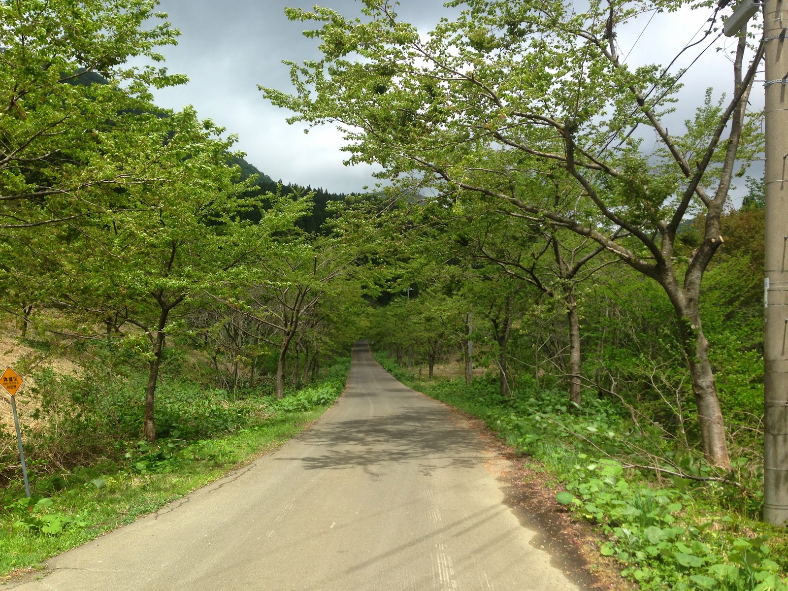
We took a back road  to avoid holiday traffic, and passed through countryside, where the roads were straight and the farming paddocks large. Quite unusual in most of Japan - and indicates relatively recent agricultural settlement.  Traditionally most roads in the countryside are narrow and windy and trace the edge of rice paddy borders and rivers.    I assumed it was because the winters there are so severe - utterly vile in fact. Blizzards, snow,  blizzards,  snow, inaccessible roads... Much of the the 1800mm or so rainfall each year comes in blizzards....   According to Hiro that's unlikely to be the reason - much of the settled parts of  the Japan Sea coast have similarly severe winter - rather it was more to do with lack of a year round water source to enable rice cultivation.    

Possibly in the past it was an area inhabited by semi-settled bear hunting clans.

We took the turn  off the coast road to Juuni ko (12 lakes) though actually there are more than 30 lakes there...It was really pretty.  Much of Tohoku used to be beech trees - their leaves are cope well with heavy snow falls - but cedar trees, the staple of the plantation industry, now dominate.  Shirakami sanchi area was too remote, too inhospitable, and too far from a port to make planations feasible. Surprisingly though the beech tree forest is only 800 years old, a product of the thawing of the last mini ice age.

I would like to go back in different seasons, in part because it looks remarkably different depending on season,  and in part because the Shirakami skyline road was still untrafficable due to snow making it impractical to go through to the other side of the forest.  This is a link to a video made by Japan's national broadcaster, NHK,   showing the park at different times of the year.   http://whc.unesco.org/en/list/663/video

One of the Juuniko lakes
Aoike (the blue lake... rather aptly named)

Beech forest of shirakami coming into spring
Beech forest of shirakami
We were lucky enough to see a wild monkey!  It had no fear of humans at all.  It stayed there quite happily, aware that there were people there.  In more heavily touristed areas / areas closer to human settlement monkeys can become very unpleasantly aggressive in demanding food.
A lake
Better not miss the bus! Train connection information is indicated in the right hand column.

http://konanbus.com/juniko/juniko.html   The bus timetable on the Konan Bus company website.
http://matiasstella.com/2009/10/22/shirakami-sanchi.html  a blog with beautiful autumn pictures of shirakami